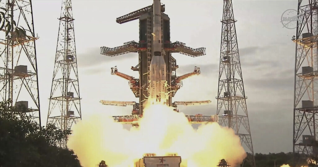
NASA and India have collaborated to launch a groundbreaking Earth-mapping satellite, designed to monitor even the most subtle changes in land and ice.
This $1.3 billion (£980 million) mission aims to provide forecasters and emergency responders with advance warning of floods, landslides, volcanic eruptions, and other natural disasters, according to project scientists.
Launched from India, the satellite will systematically survey almost all of Earth’s surface multiple times. Equipped with two advanced radar systems—one from the U.S. and one from India—it will operate around the clock, cutting through cloud cover, rain, and dense vegetation to gather highly detailed data.
Our Earth science fleet just got… NISAR.
Shortly after launch on an @ISRO rocket, the NASA-ISRO Synthetic Aperture Radar spacecraft successfully separated from its ride to orbit.
We’d say this satellite is more than nice, it’s great. 😎 Find out why at… pic.twitter.com/l5ugVYByyY
— NASA (@NASA) July 30, 2025
Microwave signals emitted from the dual radars will be beamed to Earth and reflected back to the satellite’s large antenna reflector, extended on a boom resembling a beach umbrella.
By comparing the emitted and received signals as the spacecraft orbits over the same locations every 12 days, scientists will be able to identify changes as small as fractions of an inch.
“It’s a first-of-its-kind, jewel radar satellite that will change the way we study our home planet and better predict a natural disaster before it strikes,” said NASA’s science mission chief, Nicky Fox, before the launch.
Ms. Fox headed a small NASA team that traveled to India for the launch.
“Congratulations India!” Minister of Science and Technology Jitendra Singh posted following the satellite’s successful orbit insertion, adding that the mission “will benefit the entire world community.”
Casey Swails, NASA’s deputy associate administrator and member of the delegation to India, stated that it “really shows the world what our two nations can do. But more so than that, it really is a pathfinder for the relationship building.”
The satellite’s 30-foot boom will take a week to fully extend, and the 39-foot-diameter drum-shaped reflector, constructed from gold-plated wire mesh, will also be deployed. Science operations are slated to commence by the end of October.
The satellite will focus on critical measurements including: the rate of glacial and polar ice sheet melting; variations in underground water resources; land surface movement and stress leading to landslides and earthquakes; and disruptions in forests and wetlands which can lead to increased carbon dioxide and methane emissions.
NASA’s contribution to the three-year mission is $1.2 billion (£900 million), which includes the low-frequency radar and reflector.
The Indian Space Research Organisation’s $91 million (£68 million) contribution consists of the higher-frequency radar, the main satellite structure, and the launch from a barrier island along the Bay of Bengal. This marks the most substantial space collaboration to date between the two nations.
The satellite, known as NISAR—short for NASA-ISRO Synthetic Aperture Radar—will operate in a near-polar orbit at an altitude of 464 miles. It will join numerous existing Earth observation missions carried out by the U.S. and India.


